As shown in the accompanying screenshot, the top toolbar contains these tools to draw, measure, add or remove layers, change views or create heat maps.
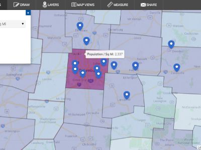
Heat Maps – Create a heat map showing concentration per square mile based on population (shown in the accompanying screenshot), total households, median household income, and more
Draw – Refine your property search based on a shape you draw on the map
Layers – Add additional layers including hospitals, airports, universities and railroads, or business locations based on 2-digit by industry code categories
Map Views – Change from the default street base map to a terrain, satellite, or hybrid base map for different context at different map scales
Measure – Measure distance on the map from one location to another to determine the proximity of a site to your key site selection factors such as interstates or rail lines
Share – Create and copy a link to email another person your map view
These tools serve to aide and enrich your property search. Try them out or contact us to conduct a property search for you.